
Map Skills Worksheet
Label the Continents
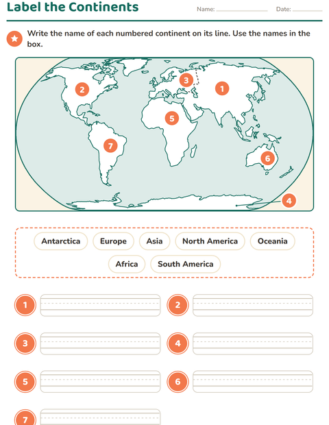
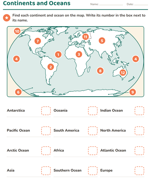
A world map fills the top of this 2nd grade page, drawn in an oval with the land in white and the sea in pale blue. Seven orange numbers sit on the seven continents, with a dashed line marking where Europe ends and Asia begins and a pointer reaching down to Antarctica along the bottom. A bank below holds the seven names: Antarctica, Europe, Asia, North America, Oceania, Africa and South America. Seven numbered writing lanes wait at the bottom, and the child writes the name of each numbered continent on its line.
Seven continents is the count most American schools teach, and the page follows it, with National Geographic as its source. The name Oceania is used for the region that includes Australia, New Zealand and the islands around them, because the map draws all of them; many US classrooms still say Australia, so mention both names. The line between Europe and Asia is dashed because it is a border people agreed on, not a coastline, and that is a good thing to point out when children ask why Europe counts as a separate continent.
One sheet, seven continents, seven names. The numbers are shuffled, so the child cannot simply write the names from left to right. A song or a clap-along naming the seven helps before the page. Continents are a common grade 2 and 3 social studies unit without a set national standard. The continents and oceans face adds the five oceans to the same map and asks for numbers instead of names.
What's inside
- Answer key included
- Print as PDF or play online — free, no sign-up
Updated September 23, 2026
More worksheets to try
Made with the Map Skills Worksheets maker
Worksheet-maker page coming soon.