
Map Skills Worksheet
Continents and Oceans
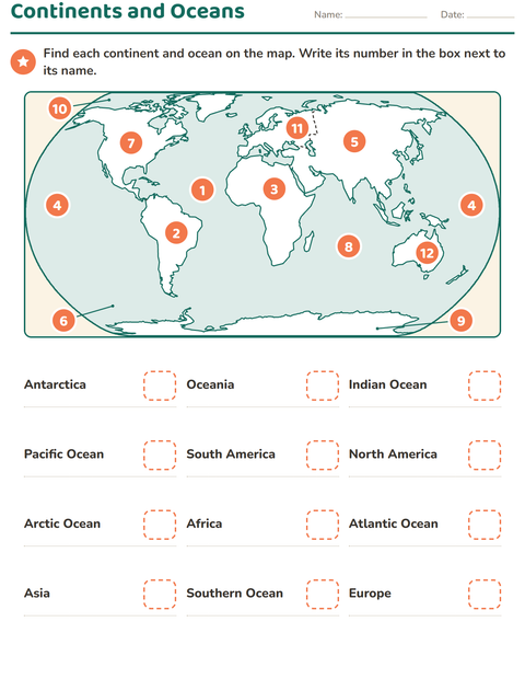
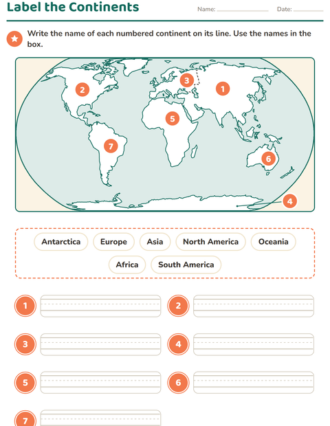
The world map of the label-the-continents page returns on this 3rd grade page, now carrying twelve numbers: seven on the continents and five in the oceans. The Pacific is numbered twice, once at each side of the map, because it wraps round behind the picture. Small pointers reach to the Arctic Ocean at the top and to Antarctica and the Southern Ocean at the bottom. Below the map sit twelve names in three columns, from Antarctica and Oceania to the Atlantic and Southern Oceans, each with a dashed box. The child finds each place on the map and writes its number next to its name.
Adding the oceans turns a list of land into a whole map, and it is where children realize that most of the world is water. The count follows National Geographic: seven continents and five oceans, with the Southern Ocean recognized in 2021, so some older materials in your room will show four oceans. Writing numbers rather than names moves the work onto the map: the names are printed, and the task is finding where each one is. The Pacific appearing twice is the moment to bring out a globe.
One sheet, twelve places, twelve numbers. This is the top of the maps family and a common grade 3 unit; continents and oceans have no Common Core standard of their own. A globe beside the page answers most questions. For a follow-up, give children a blank outline of the same map and ask for the names from memory, starting with the oceans.
What's inside
- Answer key included
- Print as PDF or play online — free, no sign-up
Updated September 23, 2026
More worksheets to try
Made with the Map Skills Worksheets maker
Worksheet-maker page coming soon.